This is a hidden page – it is not accessible from the menu hierarchy. It is a series of notes to myself about things to be further researched (if possible).
Questions
- Was the whole canal worked on simultaneously, or was it constructed in sections?
- What was the management structure during construction? Were the Inland Navigation Commissioners the direct employers of all the navies or were there any of what we would recognise as contractors?
- Where the Glan Bog petered out at its southern boundary, were any works done at the start of the project to make the water flow more freely out of the bog, to lower the water level, dry it out somewhat, and thereby make construction easier?
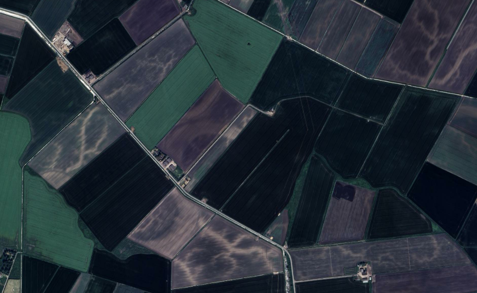
The Former Extent of The Glan Bog
The bog is very roughly marked on Nevils’s map of 1703. It should be possible, by examination of contours and field boundaries on OS maps and Google Earth to determine fairly precisely where the edge of the bog was. This is quite easy for a mile or more south of Poyntzpass, because the Co Down/Co Armagh border in that area was on the eastern side of the bog. It was a natural place to draw the boundary – exactly where inaccessible bog met good agricultural land.
On detailed soil-type maps of the area, the boundary should show up as a fairly sharp transition from glacial drumlin soils to much more humus-rich soils.
See https://www.afbini.gov.uk/article/soil-maps-and-soil-survey ?? Is the scale sufficient?
The Original Course of The Southbound River
We know that Lough Shark is at the summit level. Today, L Shark sits alongside the canal, and when operational, fed the canal via a sluice. However, it is clear from Nevil’s map that originally, the lough was more than that; it was the source of two distinct rivers. One flowed north from the NW corner, and the other (the larger of the two) flowed south from SW corner. Flow in either directions would have been very slow, otherwise L Shark would have been very quickly drained!
Nevil’s map represents the southern watercourse as being a very substantial channel. However, it would be a mistake to think of that breadth of open water as being ‘the river’. Open water could either imply a fast-flowing channel whose speed suppressed emergent vegetation, or, much more likely, an area where the water was too deep to permit emergent vegetation. It was likely that, in its ‘unimproved’ state, the Glan Bog was very like a much smaller version of the East Anglian fens.
I would like to try to map the original course of the southern central drainage channel, but perhaps no clues remain in the landscape itself?
One possible route to investigate – in large flat boggy areas such as the fens, silt deposition was at its peak in the main watercourses, and in bare ploughed areas in winter, these ‘roddens‘ show up clearly.
The Precise Route – Why?
Why the precise route we see today was chosen fascinates me.
In the early 1700s, constructing a waterway which runs for a large part of its route through a bog was a much more complex task than constructing (say) a new road, or even, a few decades later, constructing one of the early English canals which in most cases (apart from at locks) were essentially contour-followers and could mostly be constructed ‘in the dry’.
One approach is to, like those later English canals, just follow the contours – build the canal hugging a hillside as much as possible
…………………………………
What Materials Were Used?
- How were the banks built up?
- Was a brushwood base used as was later used for railway foundations across the bogs? Or was as a crushed stone base used to create a foundation?
- Were there any internal wood piles to stop the banks spreading?
- Was the towpath originally surfaced in any way, our just bare turf?
Was There A Construction Season?
In 17xx, adverts appeared in local newspapers for labourers to work on the canal in “the season” between April and August.
- Did that mean that no construction work was carried out on the canal outside of those months each year? Was it just too wet?
- How does this tie in with the construction methods used?
- Did it coincide with a slack period for agricultural workers, who could therefore earn additional income?
The Role Of The County Drain
For most of its route south of Poyntzpass, the county drain follows the Armagh/Down border remarkably faithfully. And this border was chosen in ancient times very pragmatically – it simply followed the eastern border of the Glan Bog; it was is if the Magennises and the O’Hanlons had agreed that the latter owned the bog! 🙂
One problem the designers and constructors of the Newry Canal faced was much increased flows of down the central channel in winter. It would have been highly dangerous for a lighter to use Poyntzpass lock under those conditions, going in either direction.
- The water inside the lock would have to be raised to a dangerously high level before it was even possible to open the upper gates.
- If a lighter inside the lock strayed too close to the top gate, water flowing over the top could swamp it and sink it inside the lock, effectively closing the canal to all traffic for possibly weeks on end.
- Under normal conditions, when a lighter was transiting the lock there was zero flow inside the lock. But if the top gate was over-topping, there would be a dangerous current inside the lock tending to throw the boat against the lower gates – and at a much higher elevation than usual, endangering the paddle mechanisms.
- It would have been extremely dangerous for the lightermen to try to operate the paddles; the wooden platform they stood on would have been swamped with a dangerously fast current.
Some of Bob Harvey’s winter photos from the 1950s show large flows across the tops of the locks in the years after abandonment.
All of these facts lead me to believe that the county drain was an important winter overflow. I believe that when the canal was operational, it was used to carry off excess winter water from the summit level in a parallel channel. This is supported by the fact that the bank on the Co Down side of Poyntzpass lock was much lower than on the towpath side, and fed directly into the top of the county drain. This feature was obliterated by the building of the current Baptist Church, but is clear on old maps.
Was It Built First?
The route of the county drain, for the few miles south of Poyntzpass, follows the route of the Down/Armagh border, which in turn follows the exact line where the drumlins met the bog. I think this was important for two reasons:
- It gave a perfect level; no surveying needed. Just dig along the water’s edge.
- There would have been easy access from the adjacent fields for men, horses, wagons and construction equipment.
If it was dug deep enough and wide enough, and slice-cuts made at intervals, it would compete with the main flow through the middle of the bog and help to drain it, making the construction of the canal itself drier and easier.
But this doesn’t help with understanding how, in the 1730s, excavation of waterlogged areas was achieved. By the horse-drawn equivalent of a modern powered drag-line?